The design part will present the regional and architectural intervention proposals, based on the theoretical and analytical findings. The first intervention is a large-scale master plan, which attempts to identify a point of ignition to change the direction of the ongoing continuum in the region. The approach does not aim to holistically address every encountered problem but rather focuses on the bare minimum required to prevent the region from becoming a sacrifice zone. The three architectural interventions are grounded in the context of time and place, and each of them is tied to different aspects found in the theory and analysis parts.
“66 million years”
The project involves a comprehensive masterplan for the mine with a focus on halting its continuous decay and decline. The current landscape, while rooted in production, must undergo a transformation into a multifaceted public works system that bolsters the economy, being a polyfunctional infrastructure. This entails a process of reduction.
The initial phase involves excavating soil from critical, contaminated areas within the landscape, and establishing a buffer zone for soil reclamation. In the subsequent phase, specific soil sections will be sealed and treated on-site. Following this, areas prone to landslides will be secured, ensuring stability. Thereafter, the mine's deepest recesses will be primed to serve as water reservoirs. Subsequently, portions of the landscape will be repurposed for agriculture, reminiscent of historical land use. In addition, the canal will evolve into the central axis of a verdant corridor, serving as a linear park. This transformation will foster conditions for fresh production zones that will, over time, redefine the entire territory with a renewed focus on non-profit-driven objectives.


To illustrate my examination, I've focused on a segment that traces the path of long-displaced villages. Presently, we observe the existing condition.
Before reaching closure, a segment of the landscape will transition into a buffer zone featuring soil purification facilities. This marks the initiation of soil decontamination and the inception of one of the proposed interventions.
Subsequently, other sections of the landscape will undergo soil flushing, accompanied by a separate intervention.
We will take measures to secure steep slopes against potential landslides, and the establishment of water reservoirs will create new ecosystems.
In due course, the landscape may evolve into an alternative energy production source or a hub for bio-industry. Alternatively, we may be compelled to shift our focus toward water sourcing or reclamation methods due to the escalating temperatures if our current measures prove inadequate.
I see the role of architecture within that context as acupunctural, highlighting certain moments as points of intensification. I am touching a particular place at a specific moment as a first step, which suggests the new direction of the hinterland.

Object 1: critical section

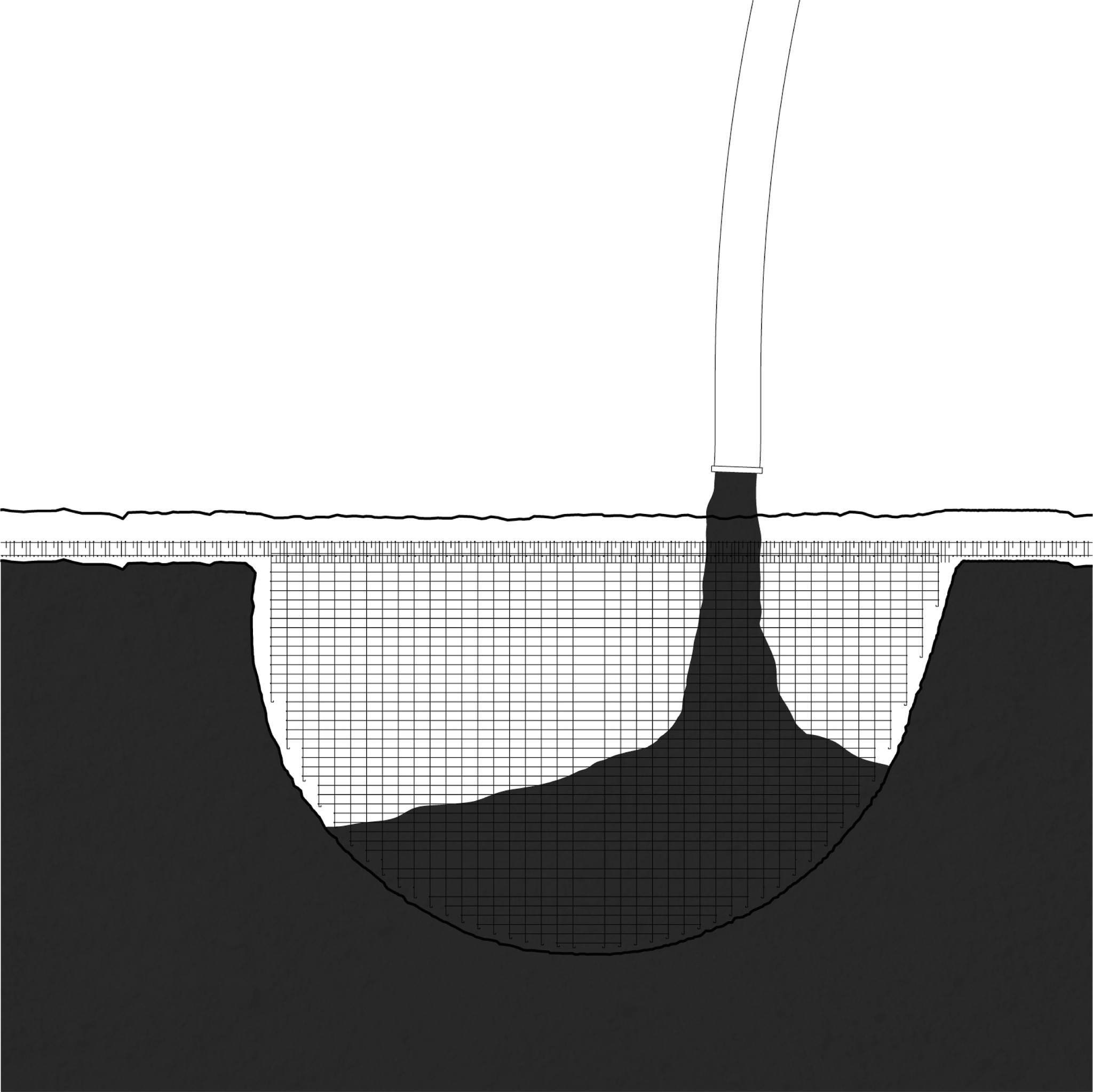
The critical section is a part of the landslide mitigation system. An intervention aimed to prevent further erosion of the soil incorporates a land-art design of a large soil-section profile. The site connects four temporalities: The untouched land, an archaeological site, the reminiscences of a former village, and the land in transition, via a vertical point of access situated in the corner of a section.
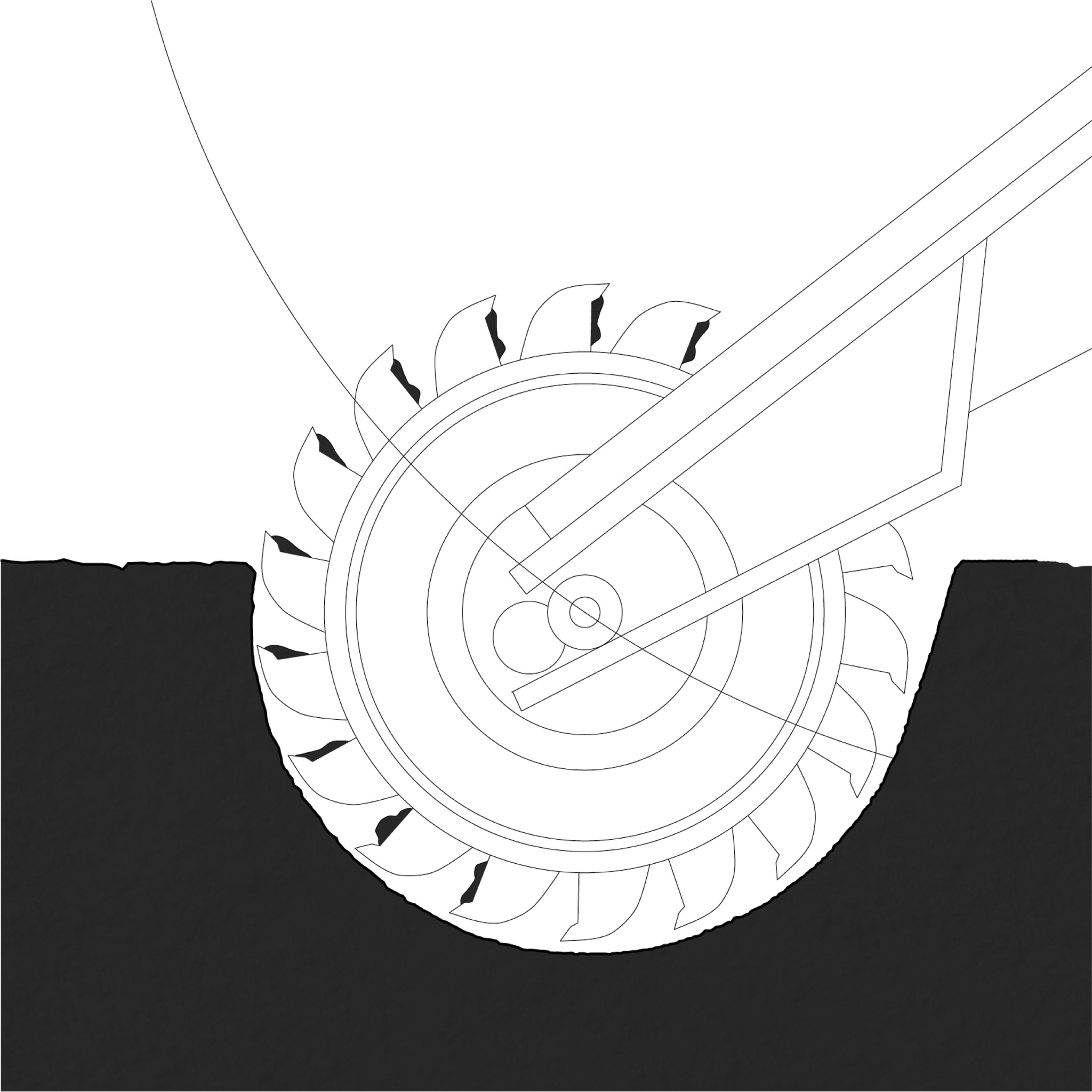
The intervention cuts into the grounds of the displaced Mavropigi village, to reveal its geological layers, the temporalities of neolithic settlements, as well as the communities’ displacement, allowing for observing and understanding the territory of a Ptolemais Basin.

Past and present are revealed and connected, by means of the cutting tool - bucket wheel excavator. Starting from the highest level, the machine consequently cuts out a piece of land, which is held in place by means of a concrete grid. The shape of the cut allows one to experience both large and small scales used in geologic research. The 10x10m grid provides a framework for changing layers of the ground. In the corner, the old archaeological grid hosts an entrance to the vertical connection between the temporalities.


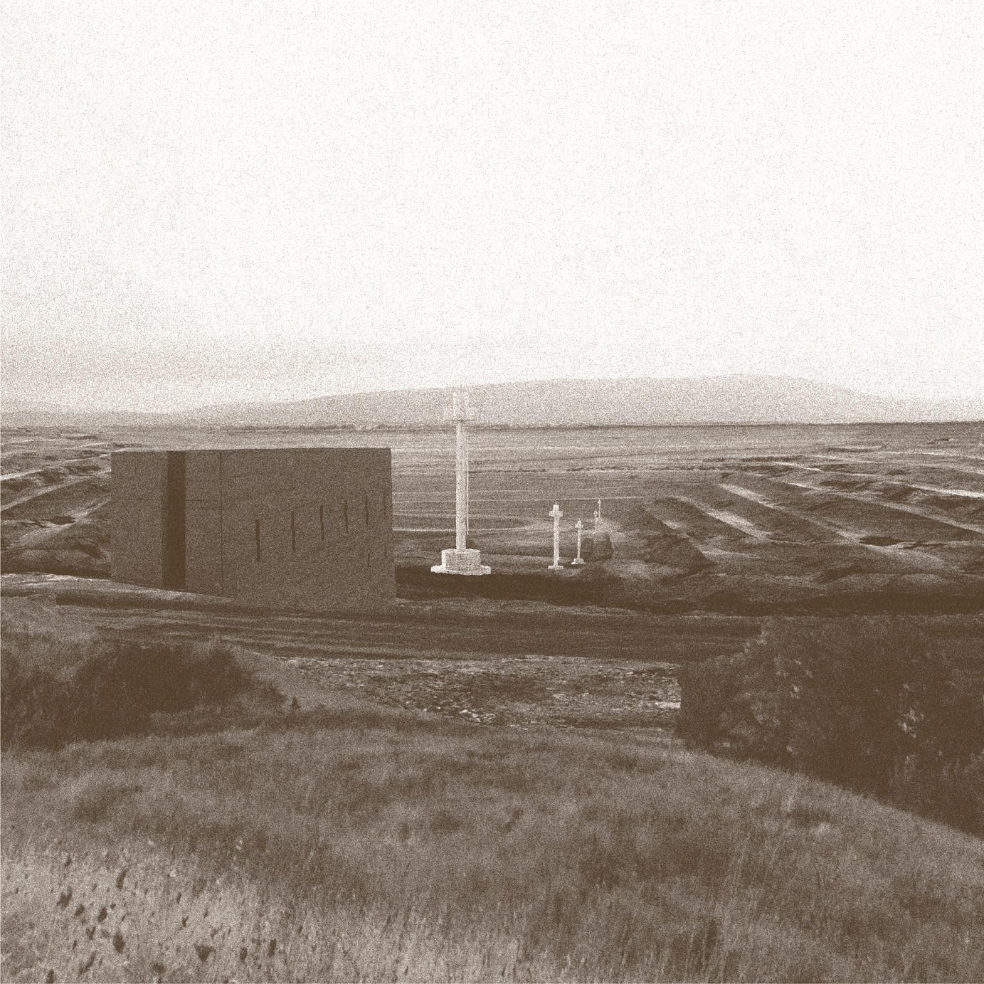
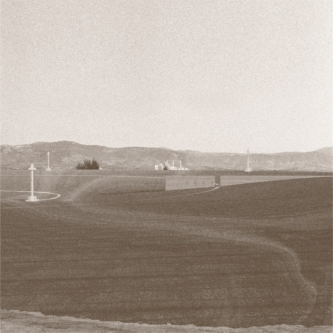
Object 2: control room

A control room is a shelter, a part of an infrastructural system, created temporarily for the phase of in-situ soil flushing. It is placed in various locations of heavily polluted parts of the quarry. Together with injection and extraction wells, it removes heavy metals from the ground, utilising groundwater currents and flushing liquids. A shelter allows for maintenance of the system, located in remote parts of the mine. A clean, repetitive form marks the toxic territories of the region, each time creating a different relationship with the landscape, as well as intervening on its visible and non-visible layers.


The project focuses in detail on one of the sites, the tumulus. The object, together with water tanks, forms a line that cuts through the landscape, creating a passage in the mound. Additionally, the second form of access in the form of a spiral slowly descends into the middle of the soil-flushing tumulus. Altogether, the in and out journey allows experiencing the soil cleaning process.


After the cleaning process is finished, shelters become obsolete.
In contrast to designing for maximum adaptability, the project aims for the systemic approach of objects with a short temporality, which intends to dissolve back into the ground after the soil flushing treatment is finished. To facilitate that, the control room will be created entirely from prefabricated rammed earth blocks. The form of the object strictly follows the advantages and limitations of using only one material, together with the intention of its’ short decay.

Soil, and the way it is processed, defines the materiality of the building. Starting with a layer of clay which isolates the landscape, compacted soil serves as foundations, through rammed earth blocks, tiles on the floor, and cut-out openings in the internal wall to create storage space. Different widths of blocks create ridges on the façade, which speeds up the process of erosion. The interior side is sanded, to create a much friendlier-to-use surface.


Object 3: lost and found office

The last object is a pavilion structure which houses various items that have been found during the lignite extraction. Its structure anachronically displays objects from assorted temporalities, such as a 3-million-year-old mastodon tusk that has been found during one of the landslides, numerous traces of former settlements from both the neolithic period and recent past, as well as contemporary objects of daily life.

The object is built at the end of the soil removal process, located in the new, temporary pit. A context-based intervention is a reflection of the insensitive, profit-driven form of transforming the landscape. It consciously alters the process, by adding an architectural layer to it. Its form derives from the logic of cutting and filling of a bucketwheel excavator. The main tool of extraction is used to form large cuts in the topsoil, creating the mould for concrete. After pouring, the surrounding earth is removed, revealing yet another found fossil. The polished concrete roof contrasts with the untreated interior of the structure. The association of an abiding figure of the pavilion, and an ever-changing image of the hinterland, will create various outcomes in the future.